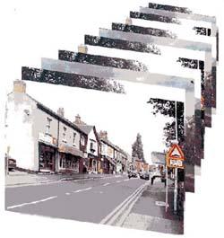
Street Photos of Barrow by Kevon Thompson


- Thirlmere Road Area
- Nottingham Road Area
- Fishpool Way Area
- Beaumont Road Area
- North Street
- High Street
- Breadcroft Lane Area
- Babington Road Area
- Beveridge Street & Industry Square
- Rookery, Soar Bridge & Bridge Street
- Grove Lane, New Street & Warner Street
- Breachfield Road, Condon Road
- Mill Lane
- South Street & Railway
- Cotes Road & The River from Soar Bridge
- The Canal
- Sileby Road & Railway E/Section
- The River & Canal
- Ribble Drive Area
- Brook Lane
- Church Street
- Melton Road
Introduction
The ‘Barrow-upon-Soar In Photographs' series was started by me in the early 1970s. Each copy was produced at home with very primitive facilities. The hundreds of photographs were produced in a makeshift darkroom, the text was hand-written and the many maps were hand-drawn. It is not surprising therefore that only 6 copies are in existence! Apart from my own copy, there are others in the Leicestershire County Records Office and the reference sections of the County Library branches at Loughborough and Barrow.
I would have liked to make the photographs more readily available but because the demand in a village would be small, the cost of a commercially produced book was prohibitive. When I acquired a computer and modest desk publishing facilities a few years ago, I thought that ‘mass' production of my work was a real possibility. I was rapidly disillusioned! The photographic quality paper and ink for computer printers are extremely expensive and the printing rate is painfully slow. The worst feature however, is that the ink is not permanent and will fade within months in daylight – not a desirable property for a work intended for use by future generations. It is of course possible to store photographs on Compact Discs but even these do not have a limitless life. Also, with computer technology moving so rapidly, there may be no means of extracting the images from discs in 10 or 20 years time.
The object of this present volume is to provide a pictorial record of what Barrow was like in the Golden Jubilee Year of Queen Elizabeth II. It is not a set of just the most photogenic aspects of the village. I have tried to show the whole village although it would be impossible to include every house etc. As a result, many of the subjects look much the same as others – particularly on the large estates but that's how it is. This is a work for for local historians in the future – after all, at present, much better views can be seen with one's own eyes!
The main storage vehicle will be a Compact Disc. Although this booklet is a ‘stand alone' work in its own right, it is intended to be a pictorial catalogue of the photographs stored on disc.
Because buildings are being erected or demolished continually, it may not be possible in the future to identify a particular feature from photographs alone. To facilitate location identification, the work is fully cross – referenced. A series of sketch maps is included and these show the position from which each of the 350 photographs was taken together with the appropriate map references and verbal descriptions of the image locations.
The booklet has been produced by an amateur using amateur equipment. The handling of a relatively large number of photographs requires a large amount of computer memory. The work was possible only by the use of a digital camera working at low resolution (in JPEG format). As a result, the views had to be presented as a series of ‘mini-photographs'.
None of the contents of my other booklets or collections may be reproduced without permission. However, the images in this collection are ‘royalty – free' .
Kevon Thompson


